fredag 28. februar 2014

Heading for Birtavarre

Friday I finished work at 12, Andreas picked me up at the hospital and we drove straight to Gunnar and packed our stuff in another car. Then we drove to Birtavarre. I think we arrived sometime around 9.30 pm. Last part we drove at  "Nordlysvegen" (The Northern Lights Route) and it really did live up to its name this evening. The road was lined with dancing green lights! We were among the first people coming. We are staying at an old shool in Birtavarre. It was quite fun because I unexpectedly met Sanna and Yngve tonight. I met them in Bohuslän I think it was about two years ago. We were all staying there during a week or more, and we were sitting around the campfire several nights. They were on this three month climbing roadtrip and stayed in their car. We were the only ones tonight not coming from Tromsø!

Time for dinner.
Camp Lofoten.

mandag 24. februar 2014

Meet Agafia Lykov

This woman is almost 70 years old, born in the wilderness and has only been 5 times to the city and claims that it makes her sick. In summer you can get here by a 7 day canoe trip, in winter it's virtually inaccessible with anything other than helicopter...


In 1978 some russian geologist spotted the farm from their helicopter and later hiked in to meet them. It was the first contact they had with outsiders for over 40 years and it marked the end of their isolation. Agafia was by that time 34 years old. The Lykovs didn't know that world war two took place.

Last weekend did not go according to plans...

We were supposed to catch the boat to Kirkefjorden friday night but universe meant different. So I was all packed and ready but had to stay home due to reasons beyond my control. Saturday I spoke to Martin and Merete about plan B which was Selfjorden. Restless as I am I repacked my stuff for the bike and headed off towards the West. Weather was horrific, strong winds mixed with snow / rain. But I kept on going until Napp when I got a message that they thought we should cancel due to the weather. Actually I agreed and took a shelter in some abandoned buildings for some lunch before heading back home again. Maybe the universe wanted me to go home, take a hot shower, stay in my sofa, watch some telly and reflect over life...

søndag 16. februar 2014

Å

Today we intended to climb the three pitch ice line at Sørvågen but unfortunately there was not much left due to the past days warm weather and rain. So instead we went to Å which is situated outermost in the Lofoten Islands and is one of the most authentic traditional fishing villages.

Outside Å you find the world's largest "Maelstrom" which has inspired both Edgar Allan Poe and Jules Verne in their writings. Å is the end of the road and one of the most fascinating endpoint some European route is likely to have. On a spit of land into the ocean the old fishing village is pressed down between cliffs and coves. The name comes from a small river, which flows into the sea in the fishing village. The village is located at the western mouth of the fjord, where cod passes both before and after spawning, and where there is always fish. Most of the professional fishing has now ended but still left are the authentic and architectural buildings. The peculiarity of the fishing village environment encountered in Å with 39 protected buildings, mostly from before 1900, makes the place necessarily much visited.

We walked all around Ågvatnet to look for the pass you need to cross when going to Stokkvika which we plan to do some day and camp. It was kind of wet today with some wind and a little snow. The pass was very high up. We also found a total new built wind shelter close to a really long ice line.

Wooden racks frames the path
Recently hanged fish.
Wind shelter.
New ice route. 
View towards Å.
View towards the pass heading for Stokkvika
East european fish workers.
Å.

lørdag 15. februar 2014

Ristind

Ballstadøya
Heading for Ristind.
Photo: Martin

Photo: Andreas
Nice couloir.
Martin above me. Photo: Andreas
Andreas and Martin.
Photo: Martin
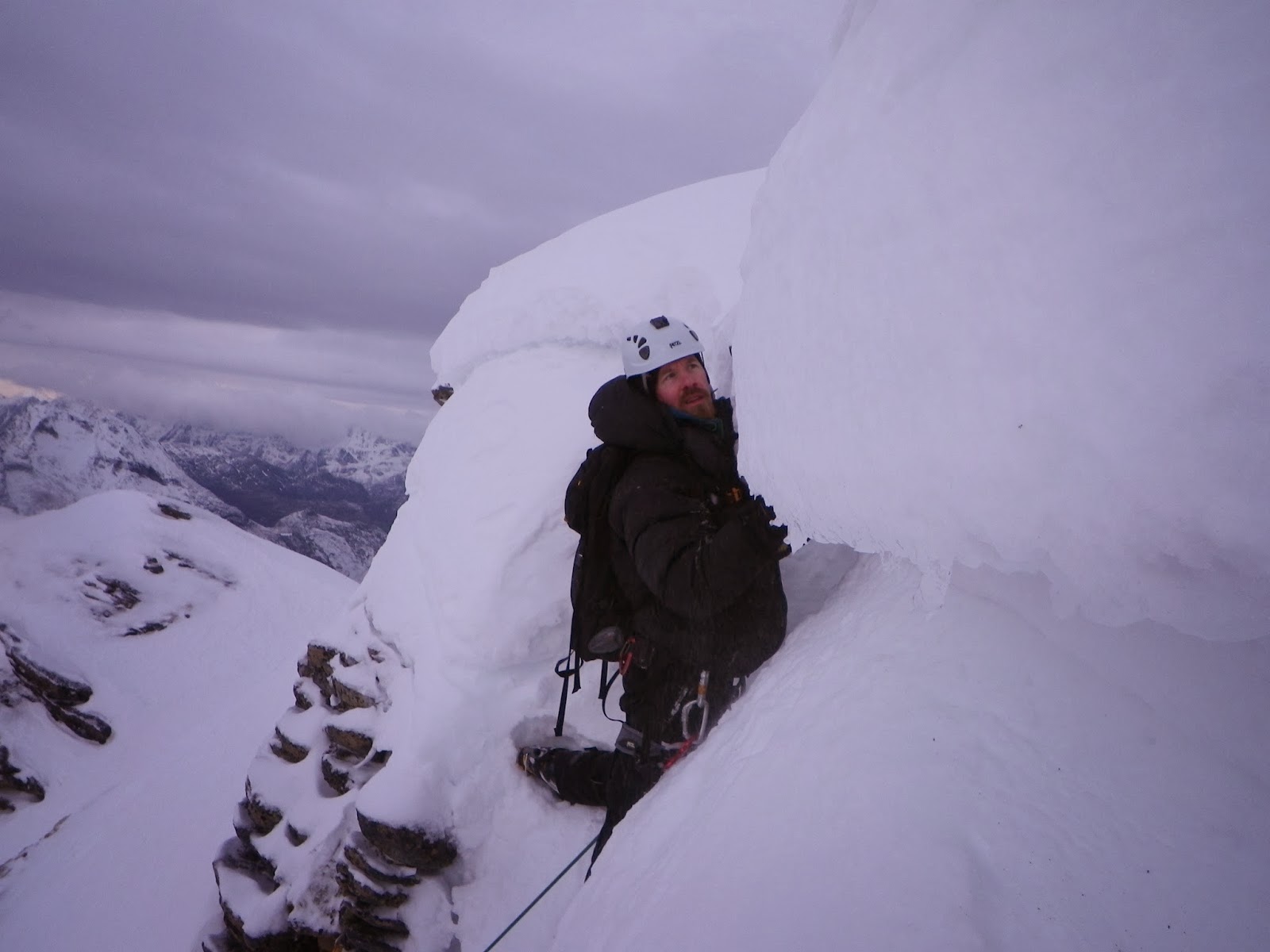
This is where I got stuck.
Not so far.
Belaying.
Photo: Martin

Relief.
Close to summit now.
Summit 862 m
Heading down.
Today we met up in Leknes and drove to the start below Ristinden. We didn't take the normal route but we found a nice couloir. It all went well up to a point...I don't get scared very often but today almost at the end of the couloir I was afraid to go any further. The others traversed before me and until now it was ok to go without rope. But one part was steep as hell with flakes of snow on top and under it was like powdered sugar which means if I slip here nothing will hold me. I just stood there hesitating and got cold but then Andreas came down with a rope. I was so relieved. Andreas lost his wool mitten but it fell all the way down the couloir so we found it on the way down. Luckily I had an extra pair with me.

søndag 9. februar 2014

Manntinden

We were not sure about the weather today but I woke up 6 and went to fill the water bottles. Weather was clear and fine. We thought it might continue snowing since last night. Woke up the others at 6.30 by boiling water. We had breakfast and then broke the camp. Packed everything and carried our stuff to the small waiting room at the jetty, then we headed up for Manntinden. When we came down we still had 2 hours until the boat would arrive so we had some lunch and a nice cup of coffe. Then we walked to the end of the road...The houses were surprisingly well kept. The most overdue was the old school building. This place really fascinates me. I'll be back soon!

Kirkefjorden.
Krokhammartind.
Photo: Andreas
The most fun part on the way.
An airy passage.
Krokhammartind.
Summit. Photo: Andreas
Time for descent.
Rusty anchors.
Weather-beaten sign.
Waiting room.
Segltind behind.
Kirkefjorden.
No activity the last 25 years...
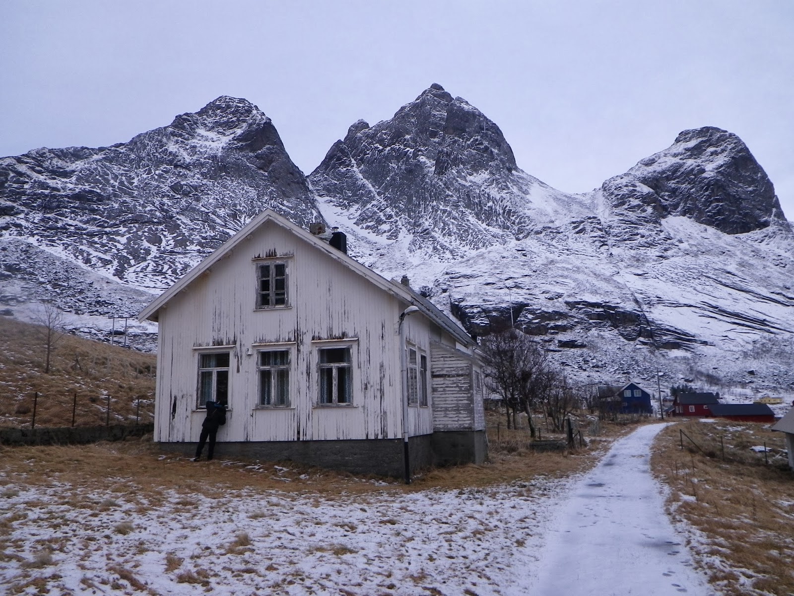
The old school house. 
House of Ragnhild, now sadly passed away.
Days gone by...
End of the road...
Marklitind, Krokhammar, Manntind. 
Boat arrives.
Heading back to Reine.

lørdag 8. februar 2014

Segltinden

Starting...
Getting higher.
Heading up Målheia.
Manntinden closest. Photo: Martin

Solbjørnvatnet.
Klokktinden in the back.
Andreas and Martin.
Andreas and Martin.
Andreas and me. Photo: Martin.
Martin.
Time to get tied in. Photo: M
I'm off. Photo: Martin. 
Martin looks for an optional way.
Summit Segltinden 731 m.
Martin.
Heading down.
Andreas like a small dot.
Photo: Martin.
Bonus Litltind on the way down.
We are down.
Today we had a really nice day heading up the valley and then Målheia, following the ridge to Segltind and heading down another way. It took us something like 8,5 hours. It started snowing on the way down. Back to the tent making dinner and plans for tomorrow. We were a bit keen on Krokhammartind but didn't think we would make it back down in time for the boat so we'll leave it for another day.